
325 videos
R209 - Web dynamique - 5. API
(R209) Initiation au développement web
- Interfaces de programmation d'applications (API)
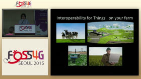
Sensor up your connected applications with OGC SensorThings API — Steve Liang
This introduction will give an introduction and live demonstration of the OGC SensorThings API. The OGC SensorThings API provides an open and unified way to interconnect the Internet of Things (IoT) devices, data, and applications over the Web. Th...
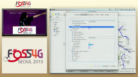
Building OpenLayers Applications with QGIS — Victor Olaya, Benjamin Trigona-Harany
OpenLayers 3 is a powerful mapping library that can be used to create interactive mapping applications. Although it has a simple, intuitive and well-documented API, it requires knowledge of JavaScript to use, and no tools exist to leverage its fun...

Akademy 2021 - Porting User Applications to Qt 6
By Kai Köhne
Qt 6 is the next major release of the Qt series. As a major release, it contains some significant changes, both in the module structure and in the external API.
In this talk I will give practical advice on how to port applications fr...
2023 | Running OGC API - Features as Smart Contract - Jan Schulze Althoff
FOSS4G 2023 Prizren
Motivation:
Emerging technologies enable hosting data and code on distributed blockchains. This has potential applications in spatial data infrastructures. A prototype was developed to assess using smart contracts for spatial ...

FOSS4GE 2024 | Creating Interoperable Tiled Maps
Tiled maps are the backbone of most web applications that show geospatial information. Before OGC API - Tiles was approved, last year, there was not really an interoperable way of creating these maps using a resource oriented architecture and JSON...
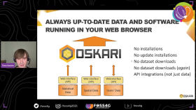
FOSS4G 2021 - State of Oskari (for end users)
Oskari (www.oskari.org) is used world wide to provide map applications with integrations to spatial and statistical data and service APIs. Oskari can be utilized as a Web GIS or as embedded maps controllable with a simple API.
This presentation w...

FOSS4G 2021 - State of Oskari (for developers)
Oskari (www.oskari.org) is used world wide to provide map applications with integrations to spatial and statistical data and service APIs. Oskari can be utilized as a Web GIS or as embedded maps controllable with a simple API. This presentation wi...
NorthSec 2019 – Kelley Robinson – Call Center Authentication
Kelley Robinson works on the Account Security team at Twilio, helping developers manage and secure customer identity in their software applications. Previously she worked in a variety of API platform and data engineering roles at startups in San F...
Creating technical API documentation and presentations - org-babel, restclient, and org-treeslide
EmacsConf 2021: Creating technical API documentation and presentations using org-babel, restclient, and org-treeslide - Jan Ypma
You can view this and other resources using free/libre software at https://emacsconf.org/2021/talks/tech .
This vide...